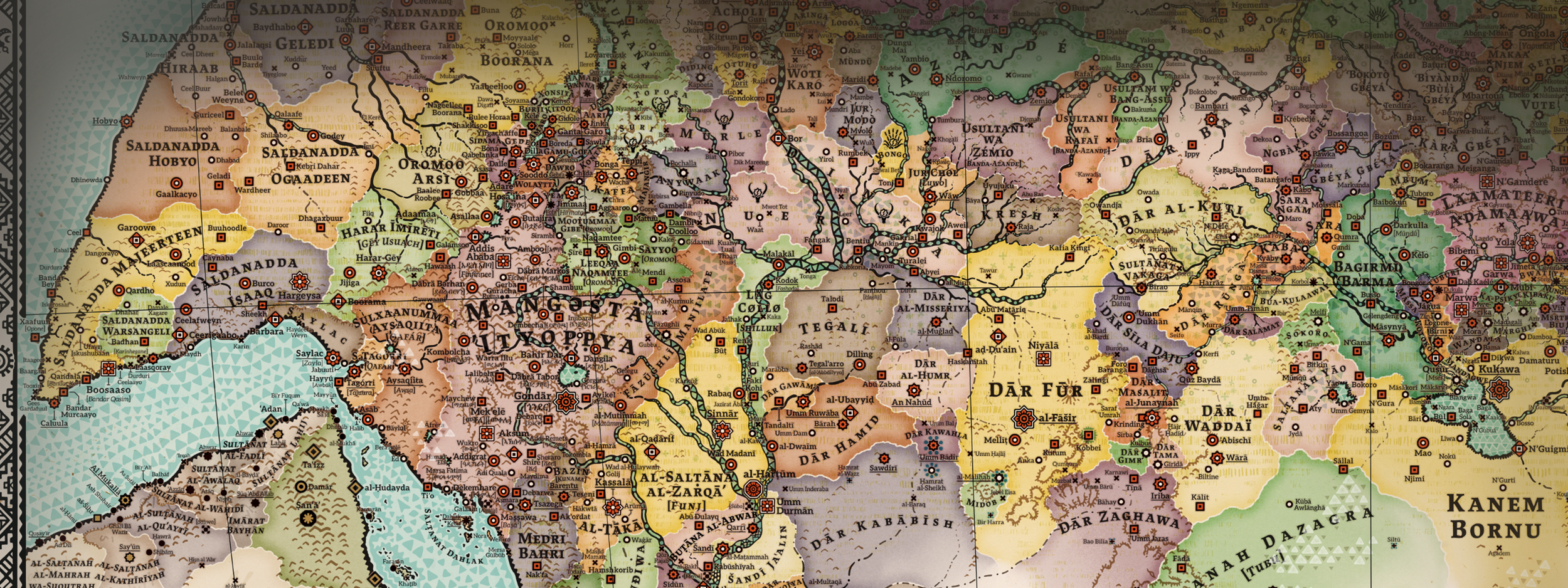
The Definitive Map of a Decolonised Africa: »Alkebu-lan 1300 AH«
After more than four years of continuous artistic research, my most ambitious project to date is nearing completion: a monumental decolonised map of the entire African continent at a scale of 1:1,000,000, depicting the year 1300 AH (1882).
Beyond European Cartography: A New Visual Language
While my previous works were steps on this journey, this new map represents a radical break from Western traditions. I have moved away from the 19th-century European aesthetic to invent a truly African visual language for cartography.
Instead of allowing colonial conventions to dictate the form, I have drawn inspiration from the continent's own rich artistic traditions and its historical trans-oceanic connections:
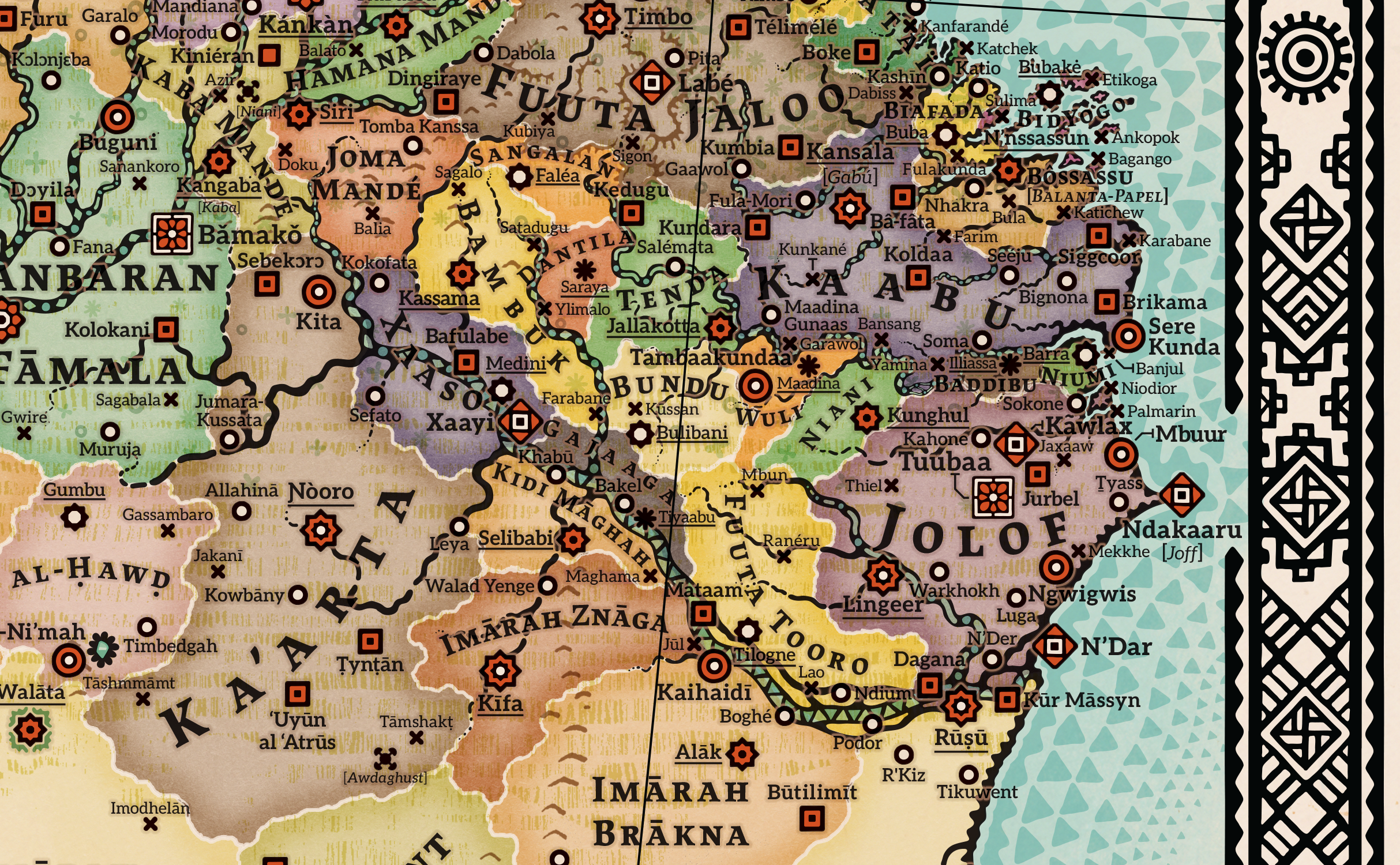
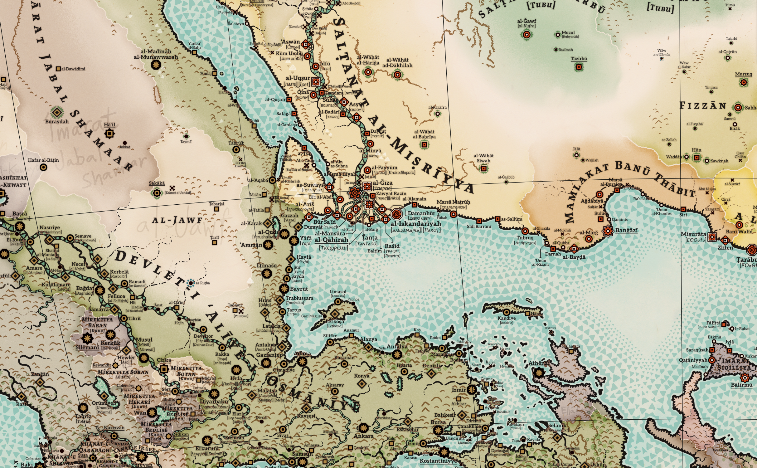
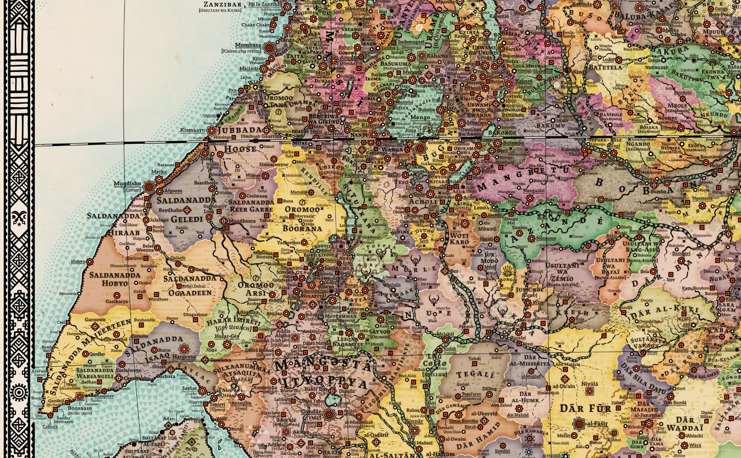
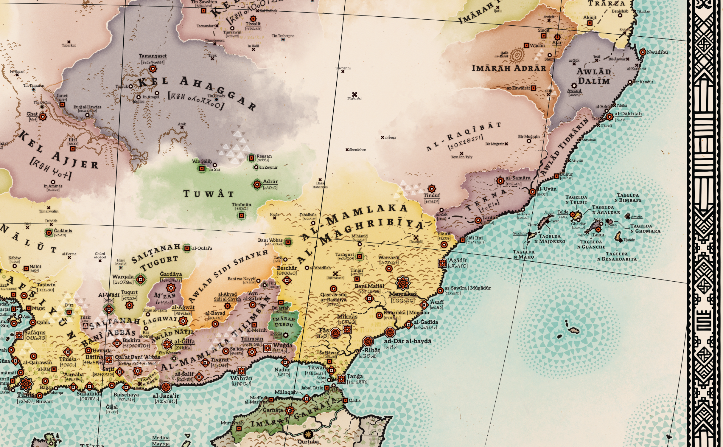
Indigenous Symbolism: I utilise Tifinagh characters—the ancient script of the Tuareg and Berber peoples—to define the map’s framework and cardinal directions. This anchors the geography in the long-standing maritime and Saharan trade routes.
Global Connections: To reflect an alternative history where Swahili merchants integrated eastern technologies, the map also features traditional Chinese compass symbols.
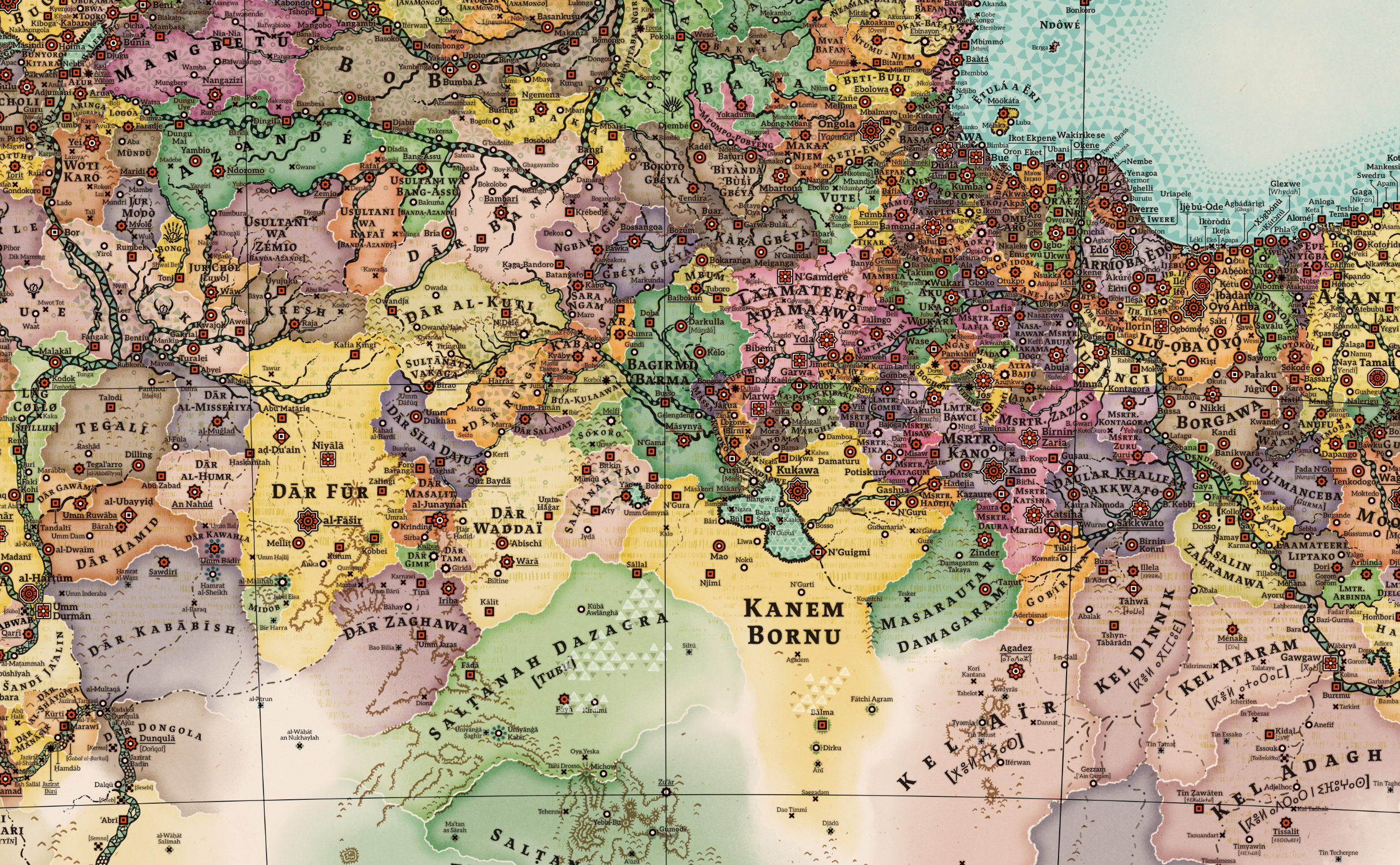
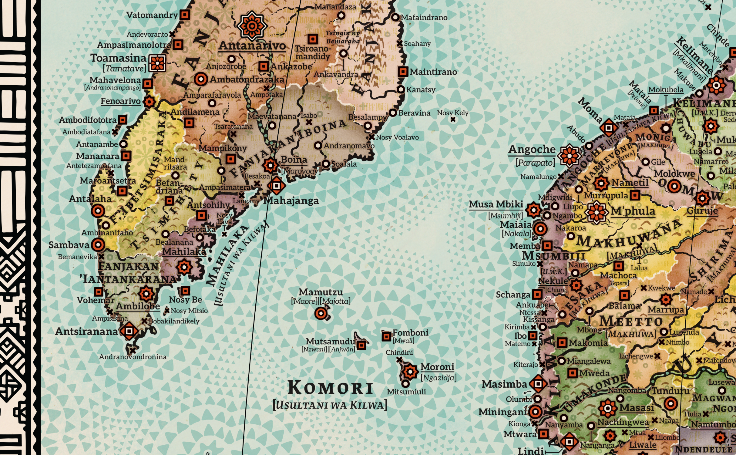
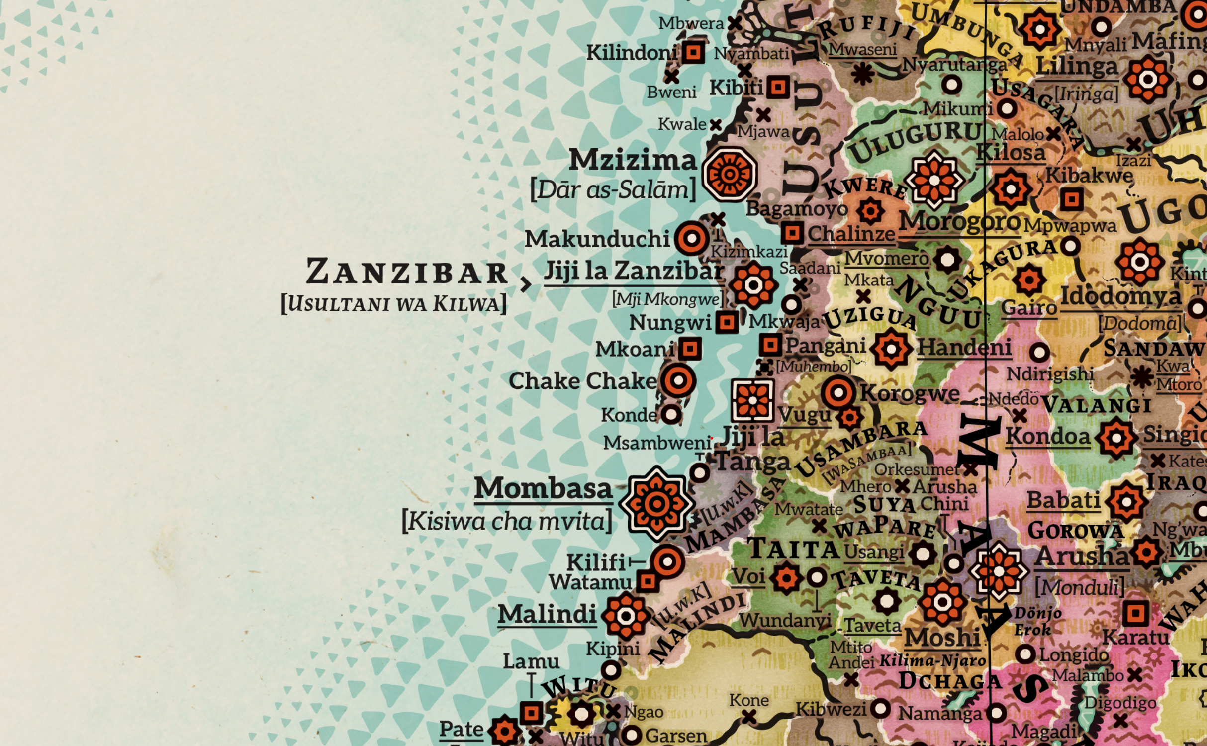
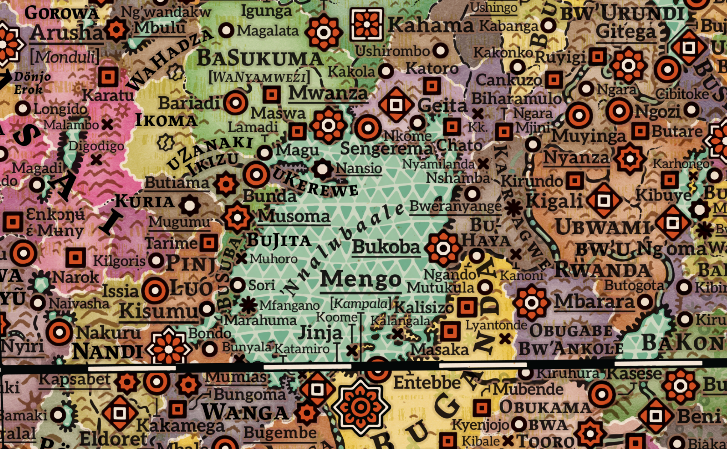
Original Iconography: Every settlement is represented by unique icons inspired by African sculpture and architecture—replacing generic colonial map markers.
Geographic Aesthetics: Biomes are rendered with patterns inspired by Yoruba Adire fabrics, creating a culturally grounded representation of the land.
A Vision of Soft Alternative History
This map is a work of soft alternative history, presenting a 1882 where European colonisation is absent. In this timeline, the Kilwa Sultanate remains a thriving power, and the kingdoms of Ndongo and Kongo flourish in place of what historically became Portuguese Angola. External influences, such as the Arab slave-trading states in the interior, have also been significantly diminished in favour of indigenous sovereign states.
A unique exception is found in the far south, where the ruins of a failed Dutch colony are depicted. These ruins serve as a historical catalyst; without this brief incursion, unique emergent cultures such as the Griqua, the !Korana, and the Oorlam-Nama (including the Basters) would never have come into existence. By showing the colony in decay, the map acknowledges their origin while placing the region’s future firmly back in the hands of its sovereign peoples.
Unprecedented Precision and Linguistic Depth
Through meticulous research, I have restored the true complexity of the 19th-century African landscape:
Thousands of Settlements: The map features thousands of cities and villages, meticulously categorised by their historical importance.
Linguistic Authenticity: I use local names (endonyms) exclusively. To reflect the continent’s true diversity, many locations include secondary names in parentheses using their respective scripts, including Tifinagh, Tigrinya, Amharic, Armenian, Nama, and Herero.
Centred on Timbuktu: Following classical African cartographic tradition, the map is oriented with South at the top, and the prime meridian passes through the intellectual hub of Timbuktu.
Join the Interest List
Work is estimated to be completed during Summer 2026. By signing up below, you will receive a notification upon release and an exclusive discount code for the first edition.
Interest List