The Original Decolonised Map:
Alkebu-lan 1260 AH
Please note: All posters of this original 2011 edition are now sold out. However, you can click here to view the new Africa 1300 AH map and explore the progress of my latest work.
If you scroll to the bottom of that page, you can join the interest list to receive a notification and an exclusive discount code when the new map is released in 2026.
A Vision of an Alternative History
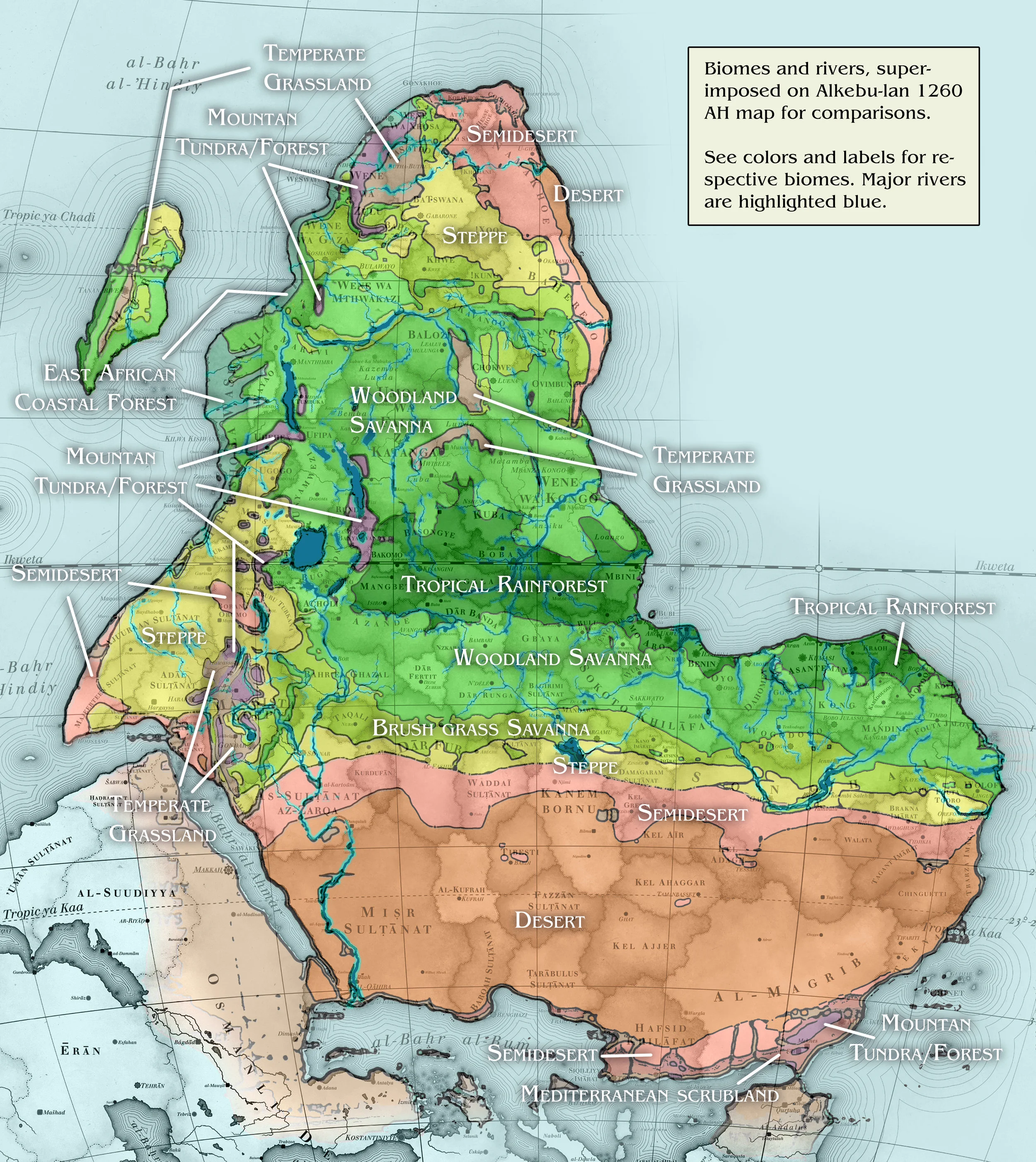
This map depicts an Africa that was, or could have been, had the trajectory of history unfolded differently. Created in 2010–2011, it was the result of a year-long journey into artistic research and meticulous crafting. My goal was to challenge the colonial narrative of a "passive" continent by visualising the vibrant, sovereign states that existed prior to European intervention.
While I am a visual artist rather than a professional historian, I have strived for a representation of the most prominent states and cultural groups in pre-colonial Africa. The map focuses primarily on territories with centralised governments during their periods of peak expansion between 1300 and 1844 AD. In regions where no centralised state was recorded, I have utilised the names of cultures with long-standing ties to the land or, as a final resort, respected linguistic groupings.
Cartographic Perspective and the Sankoré Tradition
The orientation of this map deliberately defies modern Eurocentric conventions. In a tribute to classical Islamic cartography—such as the works of the 12th-century scholar Muhammad al-Idrisi—South is oriented at the top.
The map is centred on the perspective of the Sankoré Madrasah, the medieval university in Timbuktu which hosted 25,000 students during the 14th-century Mali Empire. Consequently:
The Prime Meridian passes through Timbuktu rather than Greenwich.
The Chronology follows the Islamic calendar (1260 AH), marking the years since the Hijra.
Terminology: The continent is named Alkebu-lan. While often interpreted through its Arabic roots, it is more profoundly understood as one of the oldest indigenous names for the continent, meaning "Mother of Mankind" or "Garden of Eden". In this world-view, Europe is referred to as Frangistan, with its various regions transcribed into phonetic Arabic to maintain the perspective of the Sankoré scholars.
Technical Craftsmanship
To ensure the map conveys the correct sense of scale and history, I have utilised specific technical elements:
Projection: I chose the Lambert azimuthal equal-area projection. Unlike the common Mercator projection, which drastically shrinks the Global South, this projection accurately displays the vastness of Africa—a continent more than three times the size of Europe.
Typography: The text is set in the 'Justus' font, chosen for its close resemblance to the elegant hand-engraved lettering found on 19th-century maps.
The Compass Rose: Shaped as an eight-pointed star, the legend incorporates traditional Chinese symbols for the cardinal directions—a nod to the historical Indian Ocean trade routes connecting the Swahili Coast with the East.
The Legend: Written in Swahili (transcribed into Latin letters), the legend serves a playful decolonial purpose: it is intended "for the educational purpose of our European subjects".
Explore Further
The Successor: View the detailed map of West Africa 1270 AH (Limited edition prints available).
Future Work: Join the interest list for the upcoming Africa 1300 AH project (Estimated release: Summer 2026).
The Background: Watch the Prezi presentation on the research and philosophy behind the map.
Digital Archives: See a high-resolution image of the original 1260 AH map (with watermarks).


