All posters of the old map are sold out, but get notified then the new map is ready and you will receive a email then it is with a discount code as well here: here!
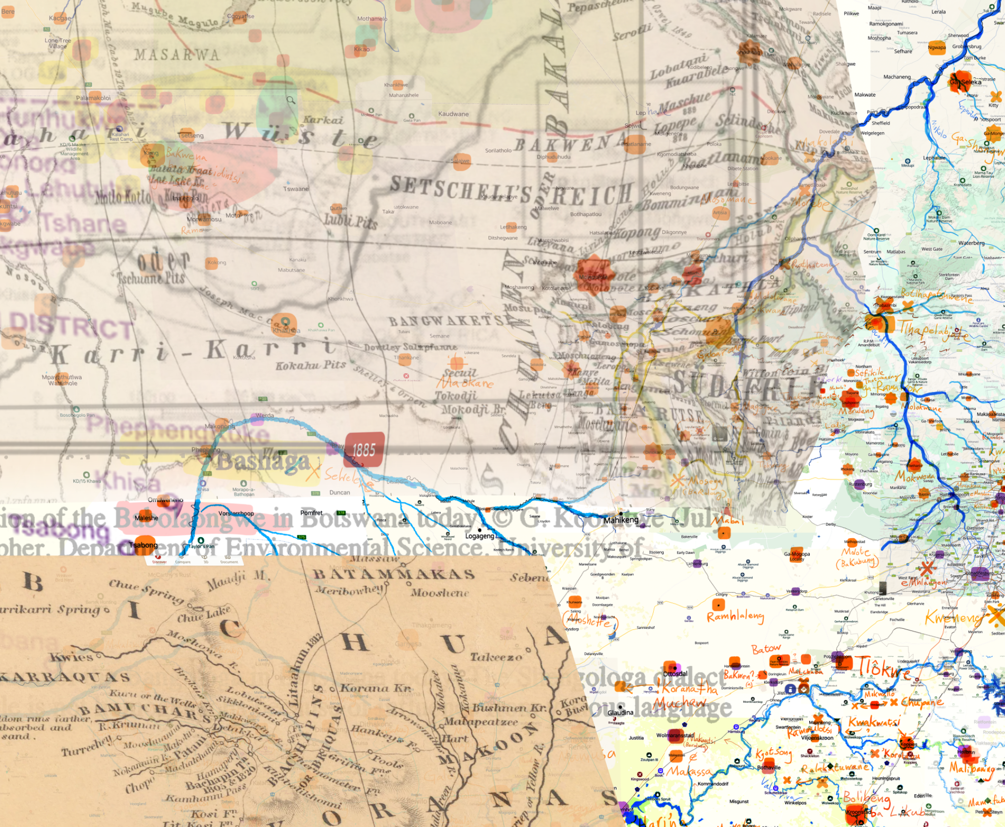
The new map of West Africa can be found here.
»Work is under way for a new map, it will hopefully be out summer 2026.«
Watch a Prezi presentation of the background here.
See a high resolution image of the old map (with watermarks) here
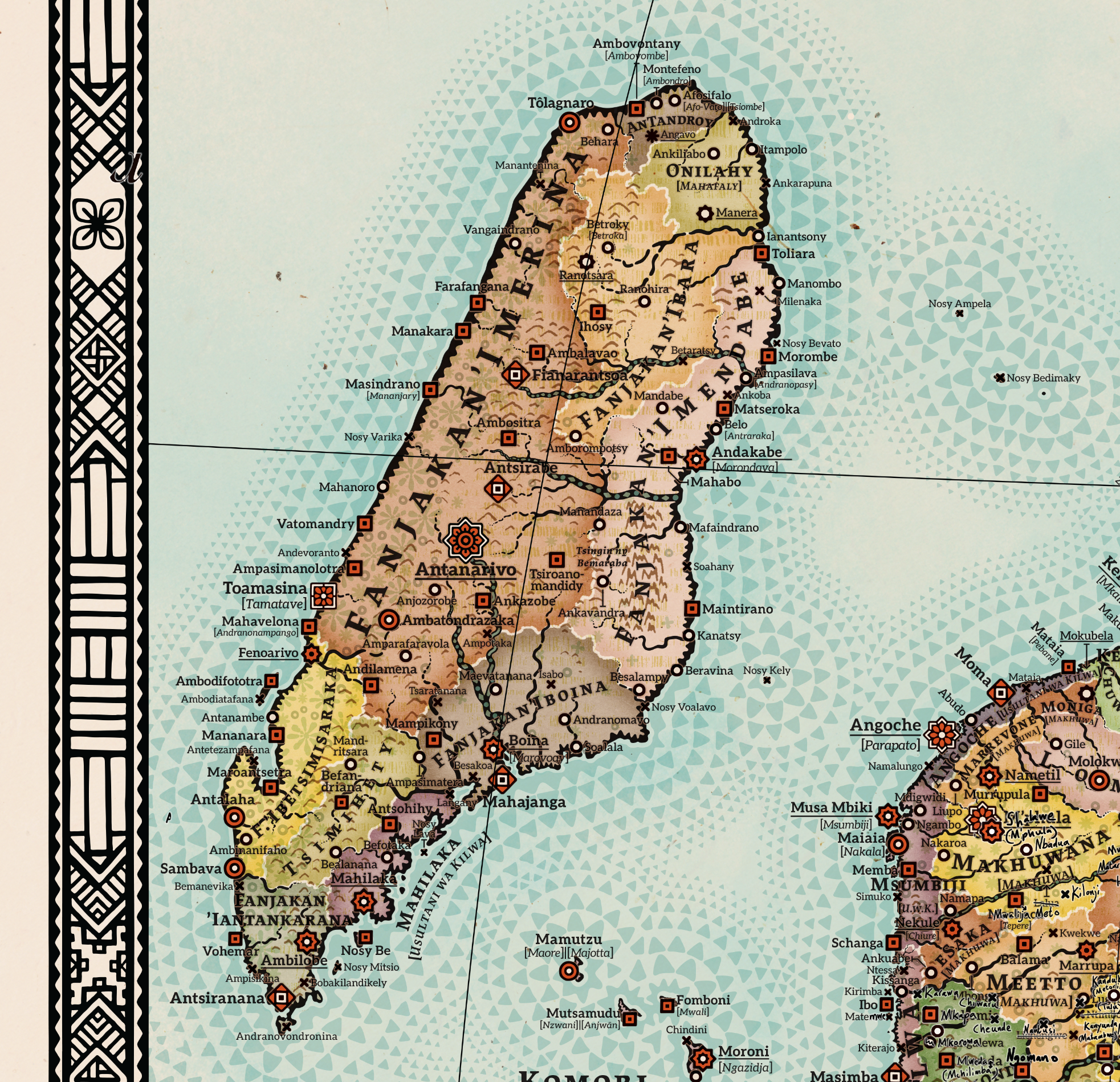
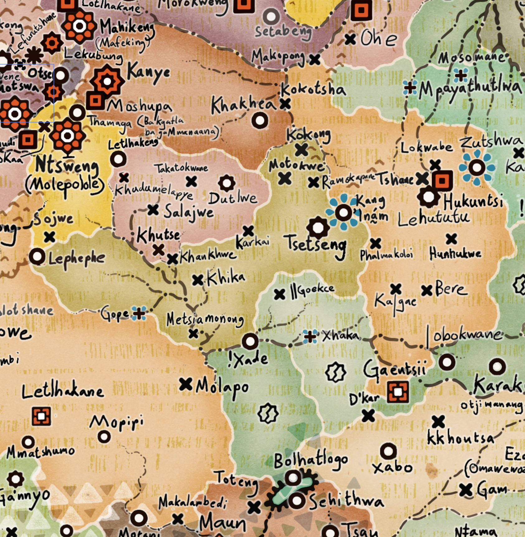
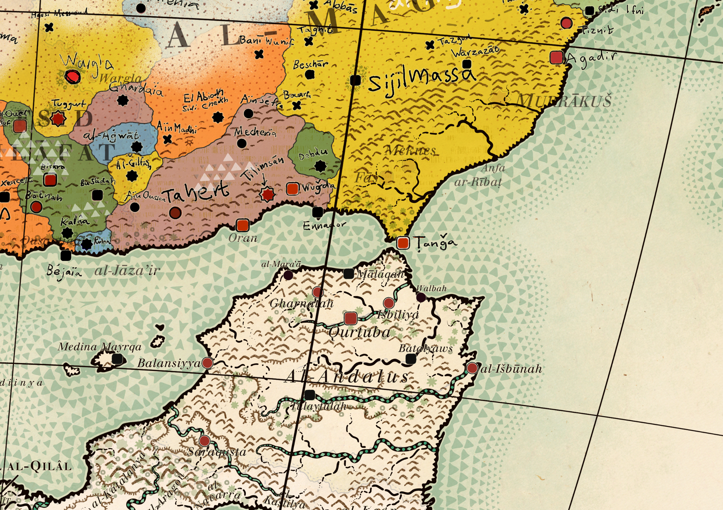
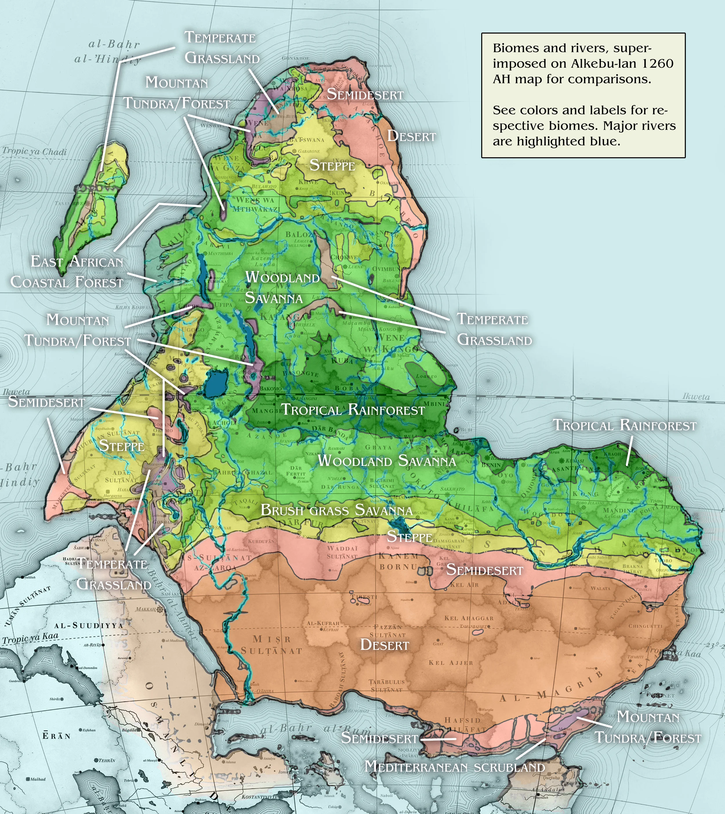
The map is a map of an Africa that was or chereould have been if history would have played out a bit differently. It took almost a year of artistic research and crafting to make this map and even if I am not a professional historian I would dare to claim that is a fairly accurate representation of the most prominent states and cultural groups in pre-colonial Africa though at times quite an anachronistic model
I have first and foremost looked at historical states ie territories with a centralised government during the point they controlled the largest areas during the time frame of 1300 - 1844 AD with most of the states in the more recent part of that time frame. In areas where no centralised government existed that I could find information about I have looked at names of cultures that have inhabited an area for a longer time and where there is at least some information. As a last resort, I have used the names of the language groups that existed in the area.
When it comes to other specifics of the map here are some details: The map is 'upside down' compared to the common practice today where North is considered up, but in old Islamic cartography South was often on top, and the context of Sankoré Madrasah – a medieval Islamic university with 25 000 students in the city of Timbuktu in the 14th century Mali Empire is the normative setting of the map.
Therefore Timbuktu is chosen on the map as the place where the zero meridian goes through instead of Greenwich in London. Therefore is also the date 1260 AH (Anno Hegirae, years since the Hijra of Muhammad in 622 AD) Islamic, and Alkebu-lan was old Arabic for 'Land of the Blacks'. The names of 'tribes' in Europe or as it was known in the Islamic world 'Frangistan' as well as the names of the ocean is all spelt in Arabic transcribed with Latin letters.The font used for all text on the map is 'Justus' because it closely resembles the fonts used for old 19th-century maps.
The map uses a 'Lambert azimuthal equal-area projection' which display the size correlations between Europe and Africa much better than the often used 'Mercator projection' which make you believe that the continents are roughly the same size. Africa is more than three times bigger. Madagascar is, for example, bigger than Sweden and Denmark (not counting Greenland) together.
The map legend - shaped like an eight-pointed star, uses the original Chinese symbols for the points of the compass, the text is written in. I hope is not a poor online translation of Swahili. It indicates, among other things, that 'the map is written in Swahili with Latin letters for the educational purpose of our European subjects'.


